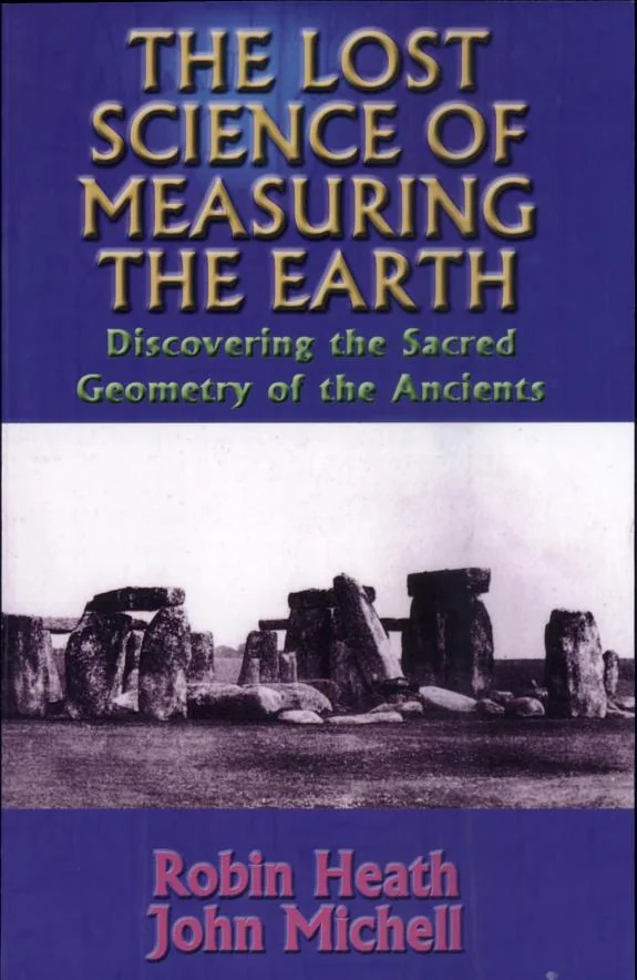
The Lost Science of Measuring the Earth
 73
73

The Lost Science of Measuring the Earth
Heath and Michell’s investigation into the systematic placement of ancient British monuments offers a significant counterpoint to purely utilitarian interpretations of sites like Avebury or Silbury Hill. Their core thesis—that a unified, lost science of measurement informed their design and location—is powerfully supported by their detailed mapping and comparative analysis of trackways, stone rows, and earthworks. The work is particularly strong in its visual evidence, presenting diagrams that illustrate intricate geometric relationships between disparate sites. However, the sheer scope of the argument occasionally leads to assertions that, while suggestive, lack definitive archaeological consensus, particularly when inferring specific astronomical alignments without corroborating textual evidence from the period. The exploration of the ‘earth energies’ concept, while central to the book’s esoteric framing, sometimes ventures into less demonstrable territory. Despite these caveats, the book provides an essential perspective for anyone studying prehistoric Britain, offering a glimpse into a potential forgotten worldview. It serves as a vital corrective to underestimating the intellectual and technical capabilities of our ancestors.
📝 Description
73
Heath and Michell argue that Britain's megalithic sites reveal a lost science of earth measurement.
This book investigates the geometric and astronomical principles believed to underpin Britain's ancient megalithic and earthwork constructions. Robin Heath and John Michell propose that sites like stone rows, circles, and trackways were deliberately placed according to precise geometric rules and celestial alignments, suggesting a sophisticated, unified system of measurement among prehistoric builders.
The authors analyze numerous monuments, many dating before 2000 BCE, to demonstrate a coherent design philosophy. This suggests a shared knowledge system among their builders, who they argue were capable of large-scale, systematic planning. Their research challenges conventional archaeological views by suggesting these ancient peoples possessed advanced geometrical and surveying techniques, encoding this knowledge into the landscape itself to create a sacred geography. The book examines patterns in site placement and intervisibility, linking them to an understanding of earth energies and celestial cycles.
This work fits within the tradition of archaeoastronomy and earth mysteries, which seeks to uncover lost cosmological knowledge in ancient sites. It aligns with scholarship that interprets megalithic structures not merely as primitive constructions but as expressions of advanced scientific and spiritual understanding. The book's focus on precise measurement and its connection to earth energies and celestial cycles echoes themes found in esoteric interpretations of ancient civilizations and their relationship with the natural world.
💡 Why Read This Book?
• Understand the proposed geometric principles used in prehistoric British monument design, moving beyond simple astronomical observation to a unified landscape measurement system. • Explore the authors' theory of a lost 'sacred geography' in Britain, revealing how ancient earthworks and stone circles might have functioned as a coordinated network. • Gain insight into the specific methods Heath and Michell use to analyze site intervisibility and alignment, challenging conventional archaeological explanations for these ancient constructions.
⭐ Reader Reviews
Honest opinions from readers who have explored this book.
❓ Frequently Asked Questions
What specific types of ancient British monuments does the book analyze?
The book analyzes a wide range of ancient British monuments, including long trackways, stone rows, stone circles, standing stones, and large earthworks, dating back over 4000 years.
What is the central hypothesis of 'The Lost Science of Measuring the Earth'?
The central hypothesis is that prehistoric monuments across Britain were designed and placed according to a sophisticated, unified system of measurement and geometry, suggesting a lost science.
Who are the authors of this book?
The authors are Robin Heath and John Michell. The book was first published in 2006.
Does the book offer practical applications for understanding modern landscapes?
While primarily historical and analytical, the book's exploration of ancient measurement systems and sacred geography can inform modern perspectives on landscape design and geomancy.
What historical period does the book primarily focus on?
The book primarily focuses on the prehistoric period in Britain, with monuments dating back well over 4000 years, suggesting a sophisticated understanding of measurement and design.
What kind of evidence do Heath and Michell use to support their theories?
They use a combination of detailed site analysis, mapping, geometric calculations, and comparative studies of monument placement and intervisibility across Britain.
🔮 Key Themes & Symbolism
Megalithic Geometry
The work posits that megalithic sites across Britain are not isolated structures but components of a larger, geometrically coherent system. Heath and Michell explore how principles of sacred geometry, such as the use of specific ratios and forms, were applied in their design and placement. This suggests a deliberate, shared knowledge system among prehistoric builders, aiming to harmonize human constructions with natural landscape features and celestial cycles.
Sacred Geography
This theme explores the concept of Britain's landscape as a deliberately organized 'sacred geography.' The authors argue that trackways, earthworks, and stone alignments were integrated into a network, potentially for ritualistic, navigational, or energetic purposes. This perspective views the land itself as a text or a map, imbued with meaning by its ancient architects.
Lost Measurement Science
Central to the book is the idea of a 'lost science' of measurement employed by prehistoric peoples. Heath and Michell suggest this science encompassed sophisticated surveying techniques, understanding of earth energies, and astronomical observation, far beyond what is commonly attributed to these periods. The book aims to reconstruct elements of this forgotten knowledge system.
Prehistoric Ingenuity
The research challenges the perception of prehistoric societies as rudimentary. By demonstrating the systematic planning and intricate design evident in ancient monuments, the authors highlight a remarkable level of intellectual and technical achievement. This theme emphasizes the cognitive sophistication and systematic worldview of Britain's early inhabitants.
💬 Memorable Quotes
Direct passages from the work, attributed to the author.
“Monuments dating back well over 4000 years.”
— This phrase anchors the book's subject matter in deep history, emphasizing the ancient origins of the structures analyzed and the considerable time gap separating us from their builders' knowledge.
“A remarkable breakthrough in understanding the system by which prehistoric monuments were designed and placed.”
— This highlights the authors' central claim: that they have uncovered a fundamental, previously unrecognized logic or methodology governing the construction and arrangement of ancient sites.
“Long trackways, stone rows, circles, standing stones, and huge earthworks.”
— This lists the key categories of ancient British sites that form the evidence base for the book's theories, providing a concrete inventory of the archaeological features under examination.
“The authors have made a remarkable breakthrough in understanding the system...”
— This emphasizes the perceived significance and originality of the research presented, suggesting it offers new, vital insights into the purpose and methodology behind ancient monument construction.
“The authors have made a remarkable breakthrough in understanding the system by which prehistoric monuments were designed and placed.”
— This statement underscores the book's core contribution: a novel framework for interpreting the intentionality and underlying principles behind the placement and design of ancient British megalithic and earthwork sites.
🌙 Esoteric Significance
Tradition
This work aligns with the broader tradition of Western Esotericism that seeks to uncover hidden knowledge and ancient wisdom, particularly within the context of geomancy and earth mysteries. It draws implicitly from traditions that view the landscape as imbued with spiritual significance and cosmic order, echoing themes found in Hermeticism and Neopagan interpretations of sacred sites.
Symbolism
Key symbols include the standing stone and stone circle, representing points of connection between the terrestrial and celestial realms, and potentially markers of energetic nodes within the landscape. Long trackways symbolize pathways of initiation or pilgrimage, connecting sacred sites. Earthworks, such as henges, represent cosmic diagrams or symbolic representations of cosmic order projected onto the land.
Modern Relevance
Contemporary practitioners of geomancy, sacred geometry, and landscape divination find resonance in Heath and Michell's work. Thinkers exploring consciousness and landscape, as well as those involved in heritage studies seeking to understand indigenous knowledge systems, may draw upon its analytical methods and conceptual framework for interpreting ancient sites.
👥 Who Should Read This Book
• Researchers of archaeoastronomy and archaeogeometry seeking alternative interpretations of megalithic sites. • Students of British prehistory interested in theories that posit sophisticated planning and measurement systems in ancient cultures. • Practitioners of geomancy and earth mysteries who explore the energetic and symbolic qualities of landscapes and ancient monuments.
📜 Historical Context
Published in 2006, 'The Lost Science of Measuring the Earth' emerged during a period of renewed interest in archaeoastronomy and landscape archaeology, challenging established paradigms. It entered a scholarly conversation often dominated by functionalist or purely archaeological interpretations of prehistoric sites, engaging with thinkers like Alexander Thom, whose work on megalithic units of measure had previously sparked debate. The intellectual climate allowed for more speculative approaches to ancient knowledge systems, though the book’s more esoteric interpretations, particularly concerning 'earth energies,' remained outside mainstream archaeological discourse. Unlike more conservative texts, Heath and Michell directly proposed a coherent, unified 'lost science,' a concept that departed from incremental discoveries. While not subject to formal censorship, the book's reception likely varied, with enthusiasts of alternative history embracing its findings while many academic archaeologists maintained skepticism regarding its more metaphysical claims.
📔 Journal Prompts
The concept of a unified system for designing prehistoric monuments.
Heath and Michell's analysis of long trackways and their connection to stone circles.
The proposed 'lost science' of measurement and its implications for understanding ancient capabilities.
Reflecting on the symbolic meaning of standing stones within a sacred geography.
Consider the potential for earthworks to function as cosmic diagrams.
🗂️ Glossary
Long Trackways
Ancient linear features, often earthen or aligned with stones, believed by some researchers to represent ceremonial or navigational routes connecting significant sites across the landscape.
Stone Rows
Arrangements of standing stones set in lines, often found in megalithic landscapes, whose precise purpose remains debated but is frequently linked to astronomical observation or ritual pathways.
Earthworks
Artificial topographical features, such as mounds, ditches, and enclosures (like henges), created by human activity in prehistoric periods, often with ceremonial or defensive functions.
Sacred Geography
The interpretation of a landscape as being imbued with spiritual significance, where natural features and constructed monuments are seen as interconnected elements within a meaningful, often divinely ordered, spatial arrangement.
Geomancy
A practice involving the interpretation of earth energies and patterns within the landscape, often associated with dowsing, ley lines, and the energetic properties of sacred sites.
Intervisibility
The principle of one landmark or monument being visible from another, used by researchers to suggest intentional sightlines and connections between ancient sites within a landscape.
Prehistoric Monuments
Structures built by humans during the period before written records, typically including megalithic tombs, stone circles, henges, and earthworks, dating from the Neolithic and Bronze Ages.
This book appears in 1 collection
🔮 Readers Also Liked
Browse all →


From the “Sacred Geometry” Collection
View all →


More Free Occult Philosophy Books
View all →